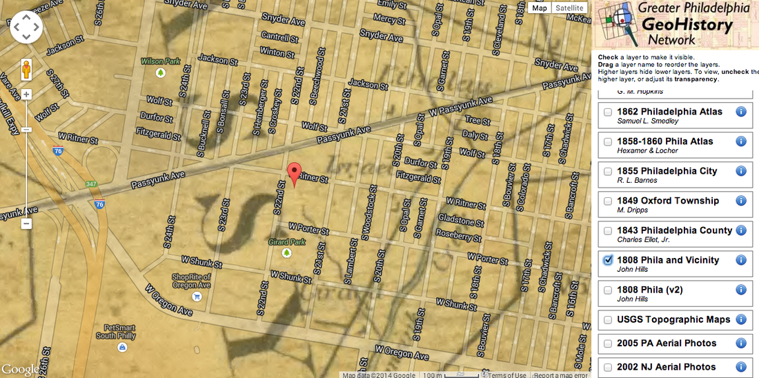
The image above (like all of the maps on this page) was sourced from the site PhilaGeoHistory, which layers modern street labels drawn from Google over historical maps from various online databases. Here, our modern maps are juxtaposed with "A plan of the City of Philadelphia and Environs Surveyed by John Hills, 1808," drawn before the city of Philadelphia was built. You can see that there were very few streets at that point (the line that divides the top and bottom county seems to be the predecessor to Passayunk Ave) and instead the city is divided into regions. Needless to say, GAMP didn't exist at this point!

This atlas was created by Samuel L. Smedley in 1862. A detail of note: you can see that the grid system has already been built into the area but that Smedley chose not to include details about houses, so the grids appear empty. This could be true, but given that if there were no demand for land to build on, there would be no reason to divide the streets up, it is likely that construction was ongoing but was excluded due to some convention. Nevertheless, you can see that the streets that we have now (with a few exceptions like Oregon Ave) were pretty much already determined by 1862.
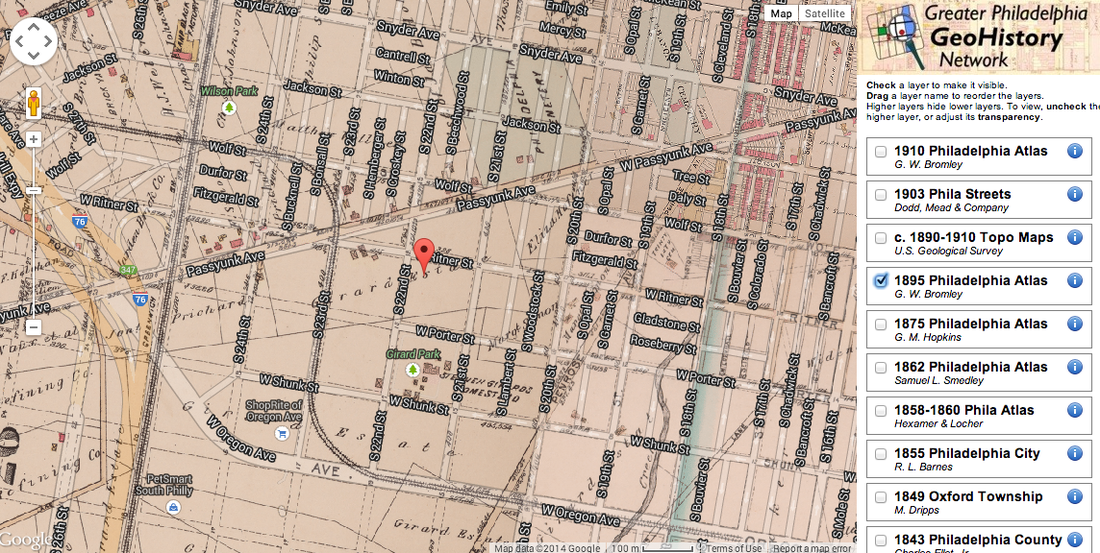
This 1895 atlas was created by two civil engineers, George W. & Walter S. Bromley and shows the development of this area of South Philadelphia from the atlas of 1892. Not only have has a railway been built on 25th St and a street car on Wolf/23rd/Oregon Ave, but you can see that the block on which GAMP is now situated was within the subdivision called Girard Estate which was a college funded by Stephen Girard.
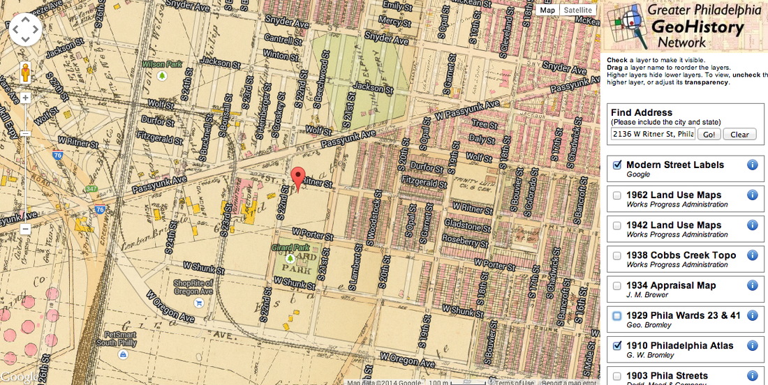
This 1910 atlas, also created by George W. & Walter S. Bromley, now includes many more details. You can see to the east of the pin for GAMP blocks of streetcar suburbs. Directly to its west, the yellow and pink buildings seem to represent Girard College's campus. Additionally, to the south, Girard Park is officially (and literally!) designated as a green space.
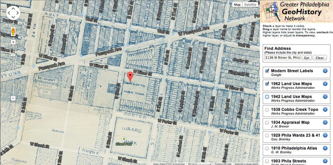
This map, published by the Works Progress Administration (a division created during the New Deal) shows the construction of the Edgar Allen Poe building, a building that continues to house GAMP and is pictured at the bottom of the page. You can see that Girard College has been replaced by Belmont Salvage Company and Crown Products Company. Similarly, while there is still a 25th St. Railroad line, the Wolf/23rd/Oregon line is no longer pictured.
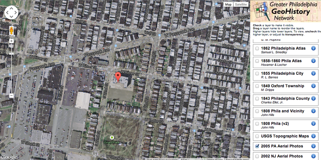
This aerial photograph from 2005 shows the neighborhood surrounding GAMP roughly as it appears today. Girard Park is more green than brown, but that may just be the time of year at which the picture was taken! The area that was once Girard College and then Belmont Salvage Company and Crown Products Company has, by 2005, become a strip mall.
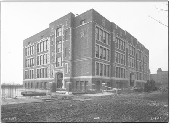
This picture, sourced from GAMP's website, was taken in 2/3/1914 after the Edgar Allen Poe School building was originally built. This year is its 100 anniversary.
