The history of the Spring Garden neighborhood goes back to pre-Revolution Philadelphia. Spring Garden was originally part of a large expanse of land that stretched from Vine St. North to Frankford Creek, and from the Delaware River West to the Schuylkill River. William Penn established the area’s boundaries and established a manor in the southern end of the district for his son Thomas, though it burned down shortly after the end of the Revolution. Ownership of the Spring Garden area was then transferred outside the Penn family. Several country estates were established, though two of these estates known as “Bush Hill,” which covered land east of 19th St., and “The Hills,” which covered land west of 19th St., were the largest. These estates did not stand for many years, however; they were divided into smaller plots based on the city’s grid system and auctioned off after the deaths of their owners in 1814 and 1813, respectively.
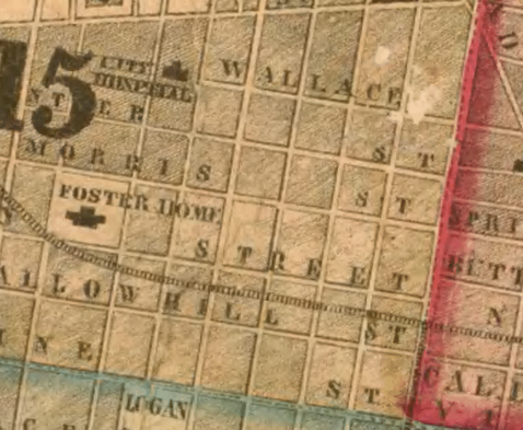
Figure 1. This 1855 Philadelphia City atlas shows marked plots ready for sale to developers. Image courtesy of Greater Philadelphia GeoHistory Network (1).
|
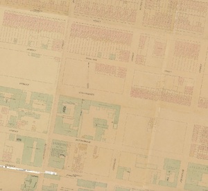
Figure 2. 1860 Philadelphia City map shows parcels of land have already been sectioned off and built on - mainly residences (pink) and industrial (green). Image courtesy of Image courtesy of Greater Philadelphia GeoHistory Network (2).
|
Spring Garden remained relatively quiet and undeveloped until approximately 1850, when urban developers began buying plots and building speculative housing projects as the city's population boomed (Seen in U.S. Census Data via Social Explorer http://www.socialexplorer.com and Figures 1,2,3).
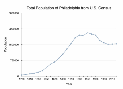
Figure 3. The total population of Philadelphia City grew rapidly starting with the industrial revolution shortly before the Civil War began. It continued to grow until the mid twentieth century with the movement of whites from the suburbs.
Many of the neighborhood’s new residents were members of the city’s blossoming white middle class, and worked as business-owners, factory managers, and artisans. Spring Garden allowed this new social sphere to live in relative comfort, without paying the high costs of historically affluent areas like Rittenhouse Square and Society Hill, or facing stigma as being of “new money.” The middle class also worked in or around Philadelphia’s industrial factories, which were located on the North side of Center City and utilized the now-defunct Columbia Railroad that runs through the south side of Spring Garden (Figure 4).
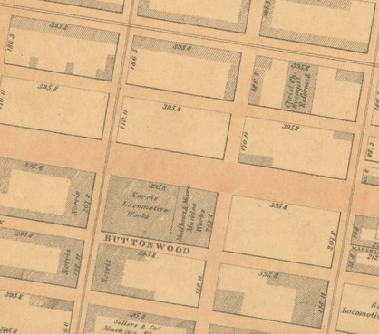
Figure 4. Spring Garden was the heart of much of the fledgling locomotive industry, as seen in this 1862 Philadelphia Atlas Image. Image Courtesy of Image courtesy of Greater Philadelphia GeoHistory Network (3).
In 1858 a horse-drawn carriage service was established in order to transport people from Spring Garden to Center City, and the Coates Street Railway Stable at 24th and Fairmount subsequently became a major regional transportation hub. The area as a whole continued to grow until the Great Depression when paved roads were introduced (Figure 5).
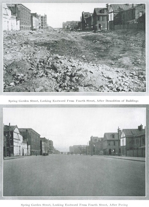
Figure 5. Before and after shots of Spring Garden Street, 1926. Images Courtesy of Hidden City Philadelphia (4).
- R.L. Barnes (Mapmaker). 1855. Philadelphia City [Map], Retrieved from http://www.philageohistory.org/tiles/viewer/.
- Hexameter & Locher (Mapmakers). 1860. 1858-1860 Phila Atlas [Map], Retrieved from http://www.philageohistory.org/tiles/viewer/.
- Samuel L. Smedley (Mapmaker). 1862. Philadelphia Atlas [Map], Retrieved from http://www.philageohistory.org/tiles/viewer/.
- [Spring Garden Street in 1926 Photograph]. Retrieved from http://hiddencityphila.org/2014/09/a-rich-past-and-possible-green-future-for-spring-garden-street/006-3-3-spring-garden-street-around-1923/.
- Philadelphia Historic Commission. The Spring Garden Historic District: A Guide for Property Owners. Philadelphia, PA: Spina (ed.).